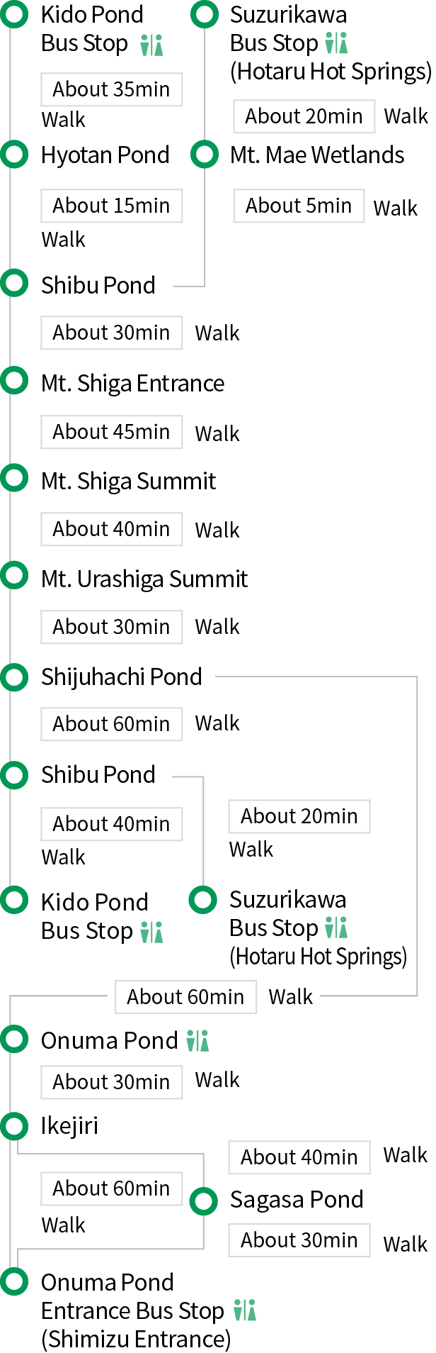
Mt. Shiga Trail
- Trails condition:
- Closed
- Challenging
- 12.6km
- 300m
- 5h30m
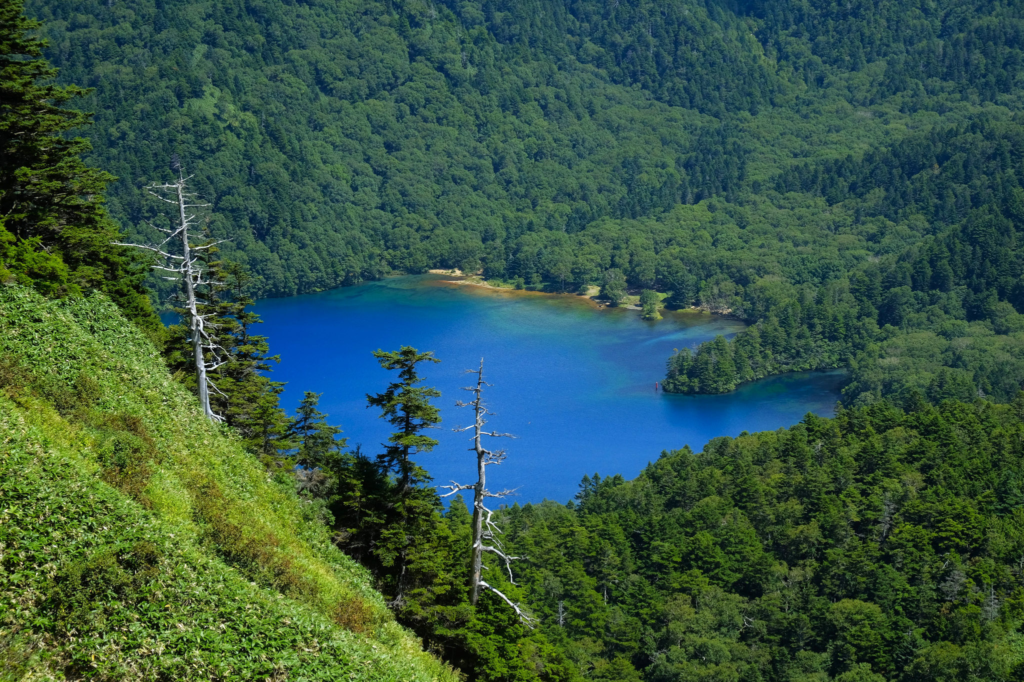
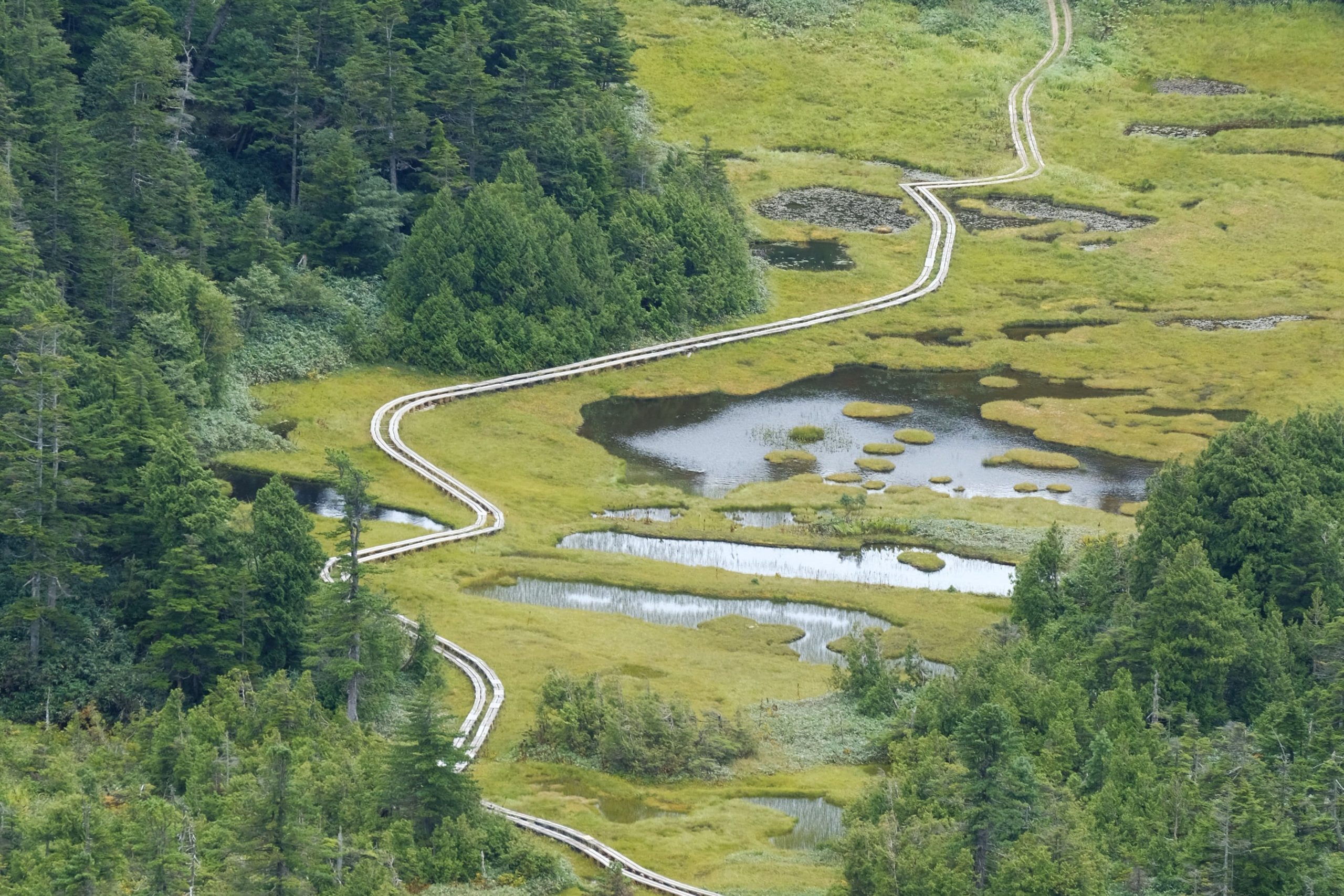
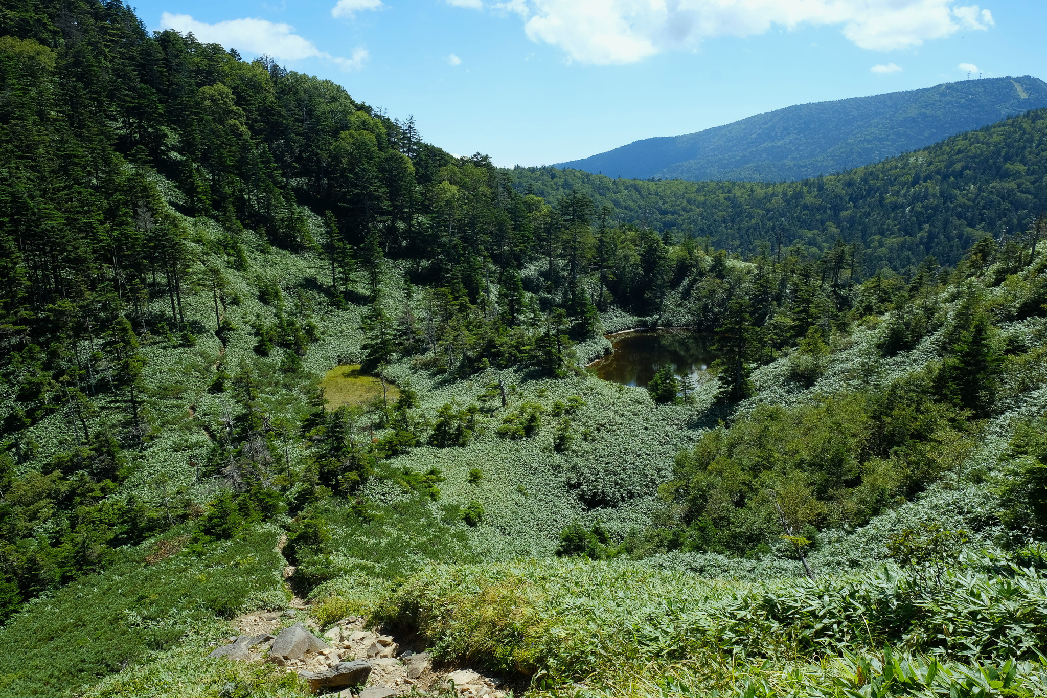
On a mountain scarred by vast lava flows, you can see ponds formed from craters. From near the summit of Mt. Ura-Shiga, breathtaking views extend over Onuma-ike Pond, Moto-ike Pond, and Shijuhachi-ike Wetland. Trailhead choice to Mt. Shiga affects the feel and duration.
Route